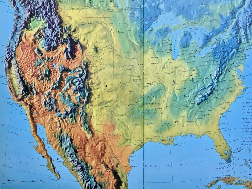
In a 2013 ad for Ford, a 1950s atlas was used to talk about an engineer who grew up on two continents. Ford’s ad does not use a contemporary map. Instead the overly dramatic images from over 50 years ago had the visual punch to make good use of its second of video time.
Ford Motor Company has been playing a television ad for the past few months. In it, Ford points to the international flavor of the developers of its 2013 Ford Escape SUV. View the commercial on YouTube here: Ford Escape Hands-Free Liftgate Commercial.

1950s Atlas
What caught my attention was the atlas used to illustrate the engineer who “grew up on two continents.”
The map looks similar to maps from Frank Debenham’s The Global Atlas–A New View of the World from Space. This atlas, published by Simon and Schuster in 1958, featured physical models of the Earth’s terrain. By photographing the models from above, the atlas conveyed the visual sense of looking at the Earth from space.
Fast forward to today.
NOT A GOOGLE MAP OR SATELLITE IMAGE
Notice that Ford didn’t use the instantly familiar Google satellite or map image to show North America and Europe. Is that because it would’ve looked flat or too plain on television?
Instead, Ford employed images that portrayed visually dramatic overstatements of the geography of Earth.
Using this kind of map image provided more communication value for the cost of occupying a second of film in a TV commercial. For a quick view, they communicated the idea of “map” more certainly than a visually plain modern internet map could have conveyed.
A similar map product is Mountain High Maps from Digital Wisdom. This set of dramatic terrain images is also a digital enhancement of physical models. View this product here.
These kinds of images stand out from the crowd, from the commonplace. As images, their value in communication exponentially rises as they catch and hold an audience.