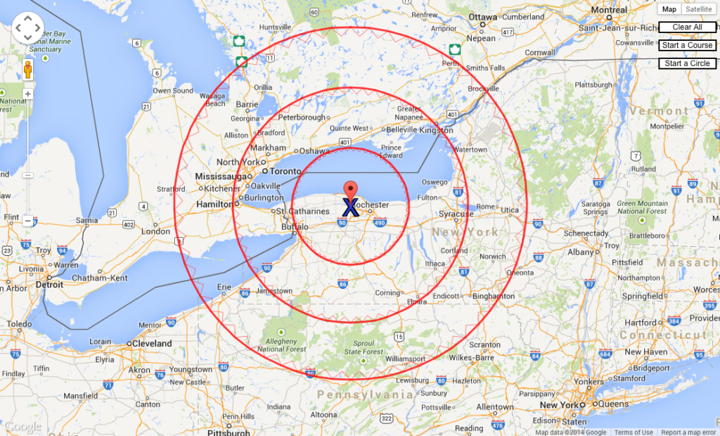
Google Maps has a scale bar at the bottom of the map. When you need to measure a distance horizontally, the scale works well. But at another angle, you’ll have a challenge using it. Instead, easily create radius rings around a point of interest. That makes it simple to measure distances in any direction.
A common request of mapmakers is to show radius rings in various distance increments.
SHOW DISTANCES GOOGLE MAPS
Combining Google Maps with radius rings can give a client a quick look at how much area, or what cities, will be included within the rings. You can quickly produce a radius rings map image at http://www.acscdg.com.

CREATE RADIUS RINGS IN GOOGLE MAPS
To create the rings, use the Find field to center the map on a location. For this map we chose Brockport, New York as the center point.

Next, click Start a Circle. The icon changes to a hand (we wish it were an arrow pointer). Hover the hand icon over the top of the Google place marker until an information box pops up with the name of the center point city. Now move the hand icon away from the center point and watch the readout on the left.

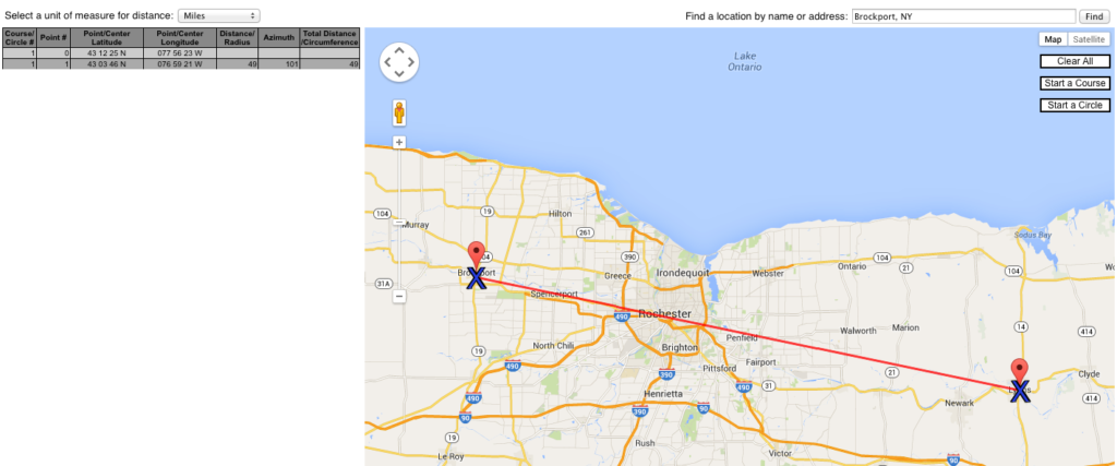
When it reads the interval you need, such as “50 Miles,” click to set the distance and automatically draw the ring. Repeat for as many distance rings as you need.With this website you can also find the straight-line distance between two locations. For example, we wanted to find the distance between Brockport and Lyons, New York. Using the site’s Start a Course function, we verified the two locations were 49 miles apart.

This website is an easy tool to create a visual of the radius rings surrounding a location.
Note: In this post, we show how to use Google Earth Pro to create and export radius rings as a .kmz file. The exports can be imported into Adobe Illustrator using Avenza’s MAPublisher plug-ins. And they can be imported directly into Google Maps as a My Maps.