Used as demonstrative evidence, forensic maps and charts communicate with juries, witnesses, and lawyers. Legal cases are often complex. We can overcome “complex” with clear, visually attractive maps and charts that persuasively communicate the facts. Demonstrative evidence is a field that requires clarity and communication. We can make it clear.
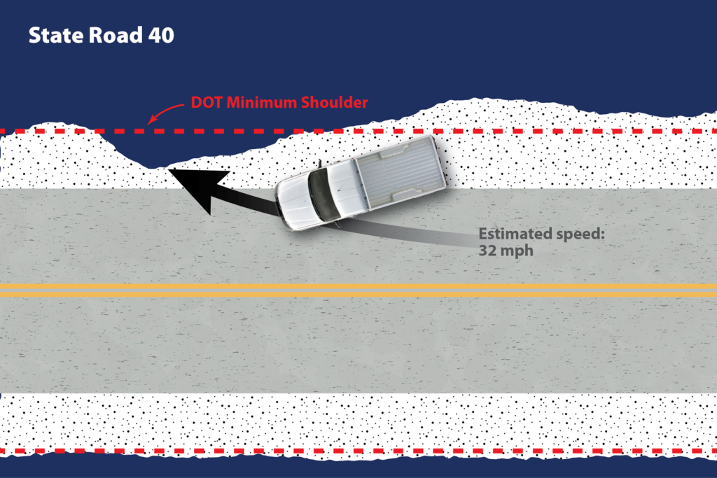
Map illustration showing accident site in a case for Robert J. DeBry.
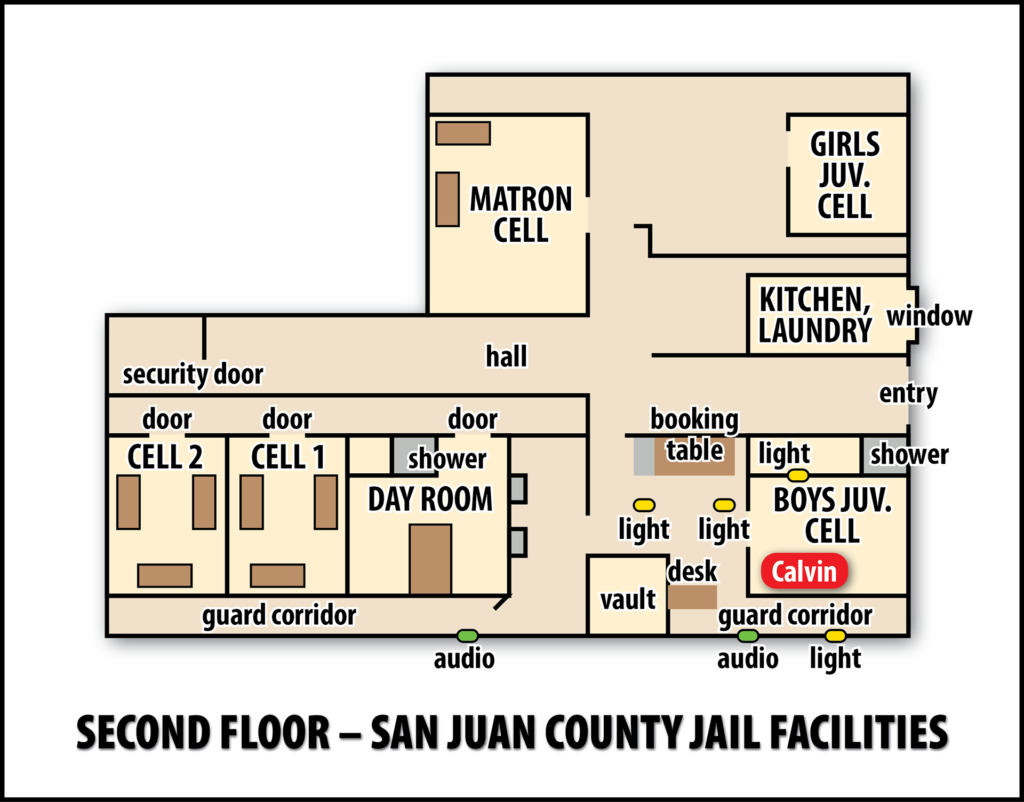
Jail facility layout used in negotiations in a wrongful death suit.
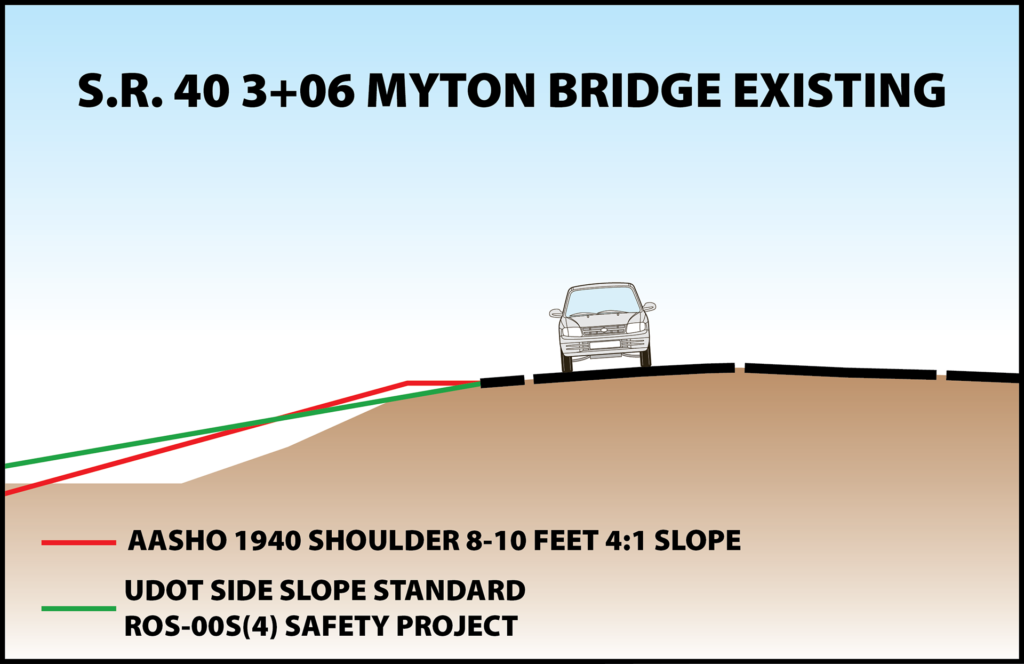
Map illustration showing shoulder widths and slopes in a car accident case.
An important value of using a map or chart in a legal case is that we build them to scale. That accuracy gives the map or chart a legitimacy that allows it to more easily be admitted as evidence. Our products combine accuracy with clarity.
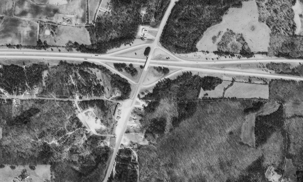
We can also find historic maps and aerial photography. The image above was 30 years old but was needed to show road and property configurations in the past. Our expertise in working with maps, imagery, and data can help you present an historical picture of a scene that looks considerably different today.