About
Print and web publications need clear, colorful maps. Their purpose: attract and illustrate. Our publication maps are made for coffee table books, textbooks, visitor guides, and hiking books.
One of our specialties is geo-political maps. These maps and graphics focus on economic, military and security topics for government commissions.
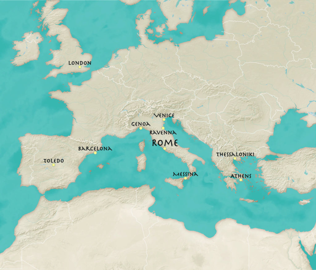
Illustrative map designed for a tour guide to old Europe
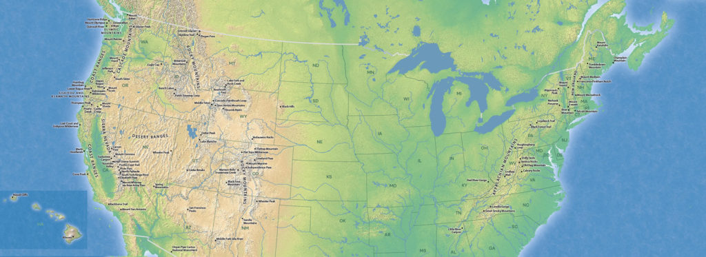
Rizzoli Publications’ Great Mountain Trails book by Tim Palmer
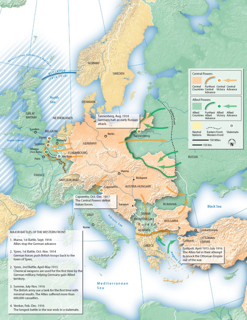
Harcourt’s textbook map of WWI Europe
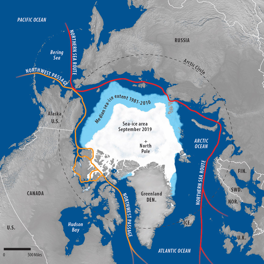
Arctic sea-ice map with terrain image and painted ice for a report for the U.S.-China Economic and Security Review Commission
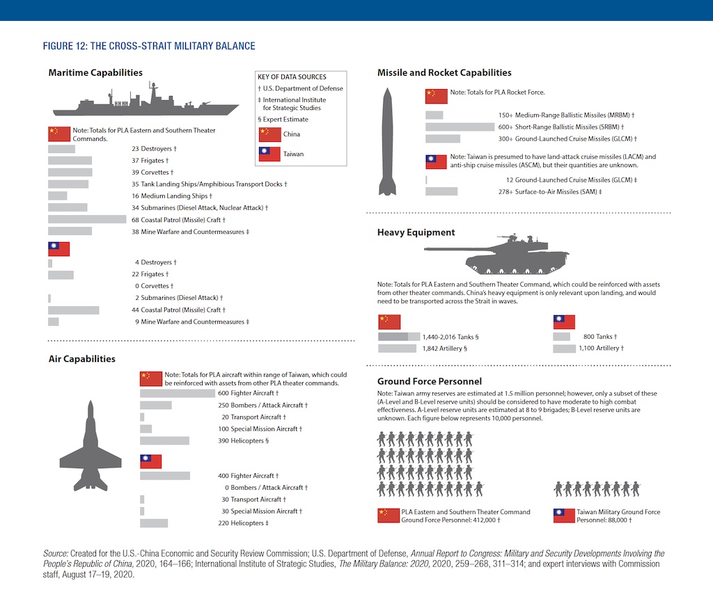
Taiwan-China military balance from the U.S.-China Economic and Security Review Commission (2020 Report to Congress)
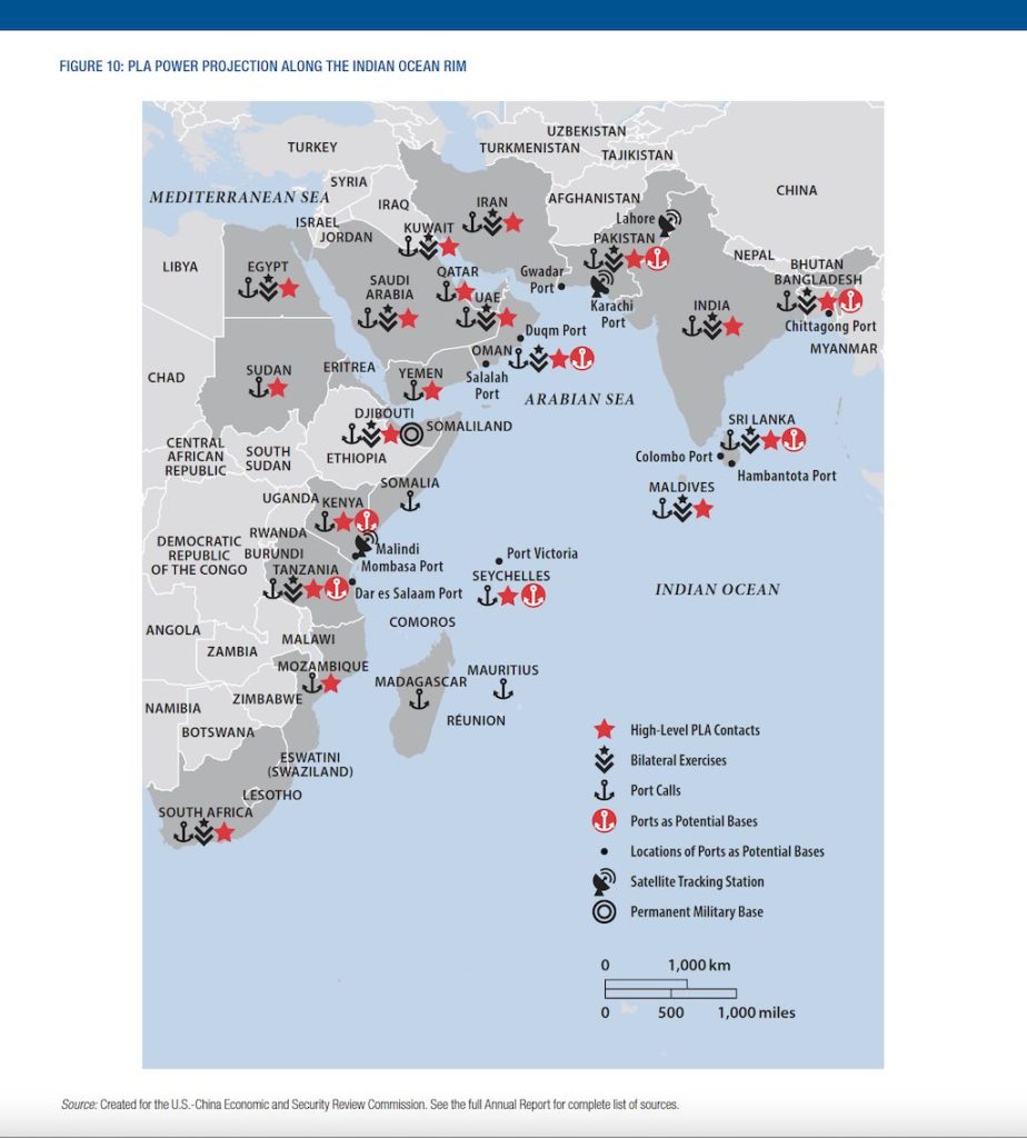
China military power in the Indian Ocean from the U.S.-China Economic and Security Review Commission (2020 Annual Report)
Get a Quote
We’re happy to create a custom quote to make your map.